A selection of our favorite treks to commemorate Public Lands Day
By Lisa Blake
A BOUNTIFUL BUFFET of trails, peaks, valleys, and vistas, Colorado’s public lands comprise more than 22 million acres, or roughly one-third, of our beautiful state.
To celebrate these national forests, Bureau of Land Management (BLM) lands, national parks, monuments, and state parks, Colorado officials declared the third Saturday in May as Public Lands Day (this year, it falls on May 16).
Owned by the public and managed by federal and state agencies, these areas spiderweb the state with hiking and biking routes and hunting and fishing opportunities, while maintaining a delicate balance between conservation and recreation.
In honor of Colorado Public Lands Day, we invite you to explore these only-in-Colorado hikes.
BYERS PEAK TRAIL
Homebase: Winter Park
Length: 8.9 miles out and back
Go For: Elevation gain bragging rights
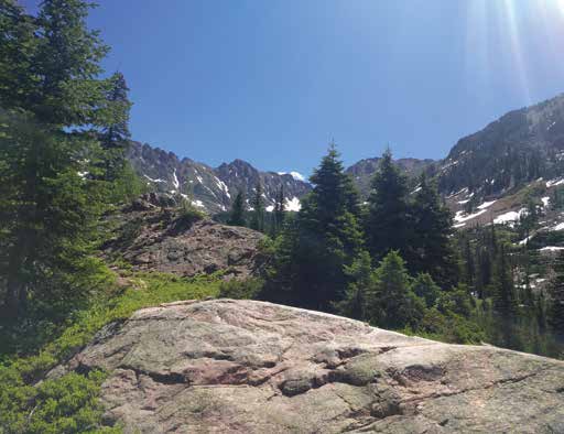
This Grand County stunner lies within the 8,801-acre Byers Peak Wilderness Area in Arapaho National Forest. The protected area was named for William N. Byers, founder of Colorado’s first newspaper, Rocky Mountain News.
Work your way up through peaceful lodgepole pine forest and delicate but hardy alpine tundra fields during the dizzying 3,000-foot elevation gain. At the 12,804-foot summit, thin crisp air and eyefuls of the sweeping Vasquez Mountains await.
BIGHORN CREEK TRAIL
Homebase: Vail
Length: 3.5 miles out and back
Go For: Wildlife, aspen stands, views for days
This East Vail favorite climbs up and out of the Vail Valley, serving up rewarding views of the jagged Gore Range and expansive Eagles Nest Wilderness.
The hike begins with a steep vertical ascent and mellows out to beautiful meadows, vibrant spring and summer wildflowers, and thick forests. Pass by beaver ponds and take in Bighorn Falls before topping out at 10,788 feet at an old homestead cabin on private property.
Please note: Parking is very limited at this trailhead. Park for free in the Vail Village or Lionshead structures and take a free bus to East Vail. Get off at the Columbine bus stop and walk north for a quarter mile until you see the Bighorn Creek Trailhead.
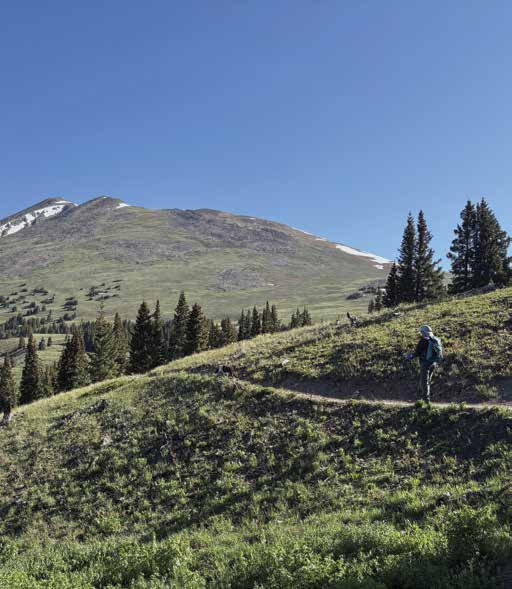
BLACK POWDER PASS
Homebase: Breckenridge
Length: 3.5 miles out and back
Go For: Wildflowers and jaw-dropping valley views
Find your way to the top of bumpy, narrow, and wildly scenic Boreas Pass Road (closed November through April) just southeast of downtown Breckenridge.
The trailhead sits within White River National Forest near the Section House historic narrow gauge railroad site. The well-maintained trail climbs above treeline with scenery unfolding in swaths of high-alpine flowers and panoramic views of the Tenmile Range and neighboring Quandary Peak.
HIGH DUNE
Homebase: Alamosa
Length: 3.1 miles out and back
Go For: Otherworldly vibes
Great Sand Dunes National Park is revered for its massive sand dunes set against the breathtaking Sangre de Cristo mountain range. Like nowhere else in Colorado, the landscape rolls in waves of awe-inspiring high-altitude sand.
The park’s most prominent dune, High Dune, is visible from the visitor center and tends to draw crowds and sunrise photographers. Follow your internal compass and zig-zag up this less-than-obvious path along the dunefield’s first ridgeline.
The trek is only 692 feet from base to top, but the sinking, sandy terrain makes it feel a bit more challenging. Pro tip: Wear boots with long pants to keep the sand out.
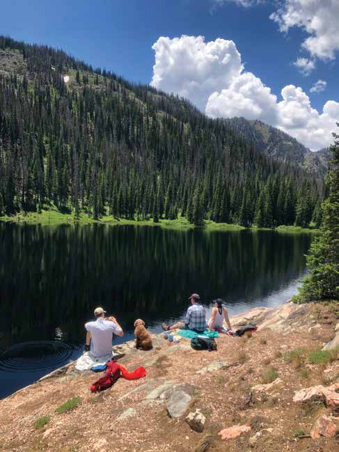
GILPIN LAKE TRAIL
Homebase: Steamboat Springs
Length: 9.2 miles out and back
Go For: The pristine high-alpine lake
Follow the Elk River on this highly rewarding Mount Zirkel Wilderness Area hike. Speckled with summertime lupine and columbine blooms, Gilpin Lake Trail climbs steadily through aspen stands and evergreens with several creek crossings (use the downed trees to keep your hiking boots dry).
When you arrive at the lake, take some slowed-down time to breathe in the reflective scene framed by rugged peaks before heading back the way you came. To extend your trip and complete the famed 11-mile Zirkel Circle, continue to Gold Creek Lake and back to the Slavonia trailhead parking area.